Table of Contents
ASSAM FLOODS
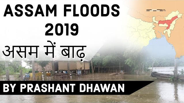
- 20 dead, 52 lakh affected in Assam floods across 4,620 villages in 31 of Assam’s 33 districts. Officials said 20 people have drowned or killed in landslips so far. At least 11 others have died in floods and landslips in Arunachal Pradesh, Meghalaya, Mizoram and Tripura. Barpeta was the worst-hit district, with as many as 7.35 lakh people facing the brunt of the monsoon fury, followed by Goalpara, Morigaon, Nagaon and Hailakandi. The rising water level of the Brahmaputra river is threatening to submerge parts of Guwahati, through which it flows. The ten other rivers in the state also swelled up dangerously as the rains continued.
SAD
- Forest officials said that 95 per cent of the Kaziranga National Park — home to the endangered one-horned rhino — has been flooded with the death of 17 wild animals in the past two days.
- Animals could be seen emerging out of the park to escape drowning.

INDIAN RHINOCEROS
- Also called the greater one-horned rhinoceros and great Indian rhinoceros, is a rhinoceros native to the Indian subcontinent. It is listed as Vulnerable on the IUCN Red List

WHY EVERY YEAR ASSAM FLOODS?
- Assam and the economic costs of climate change Assam, for instance, is extremely vulnerable to climate change due to both, its geographic proximity to the delta region and poor socio-economic conditions. This vulnerability is reflected in the exposure, sensitivity and adaptive capacity of the local population to climate induced extreme events such as floods. The state is characterised by high rainfall and a subtropical climate. It gets annual floods and frequent droughts, both of whose severity has risen due to adverse climatic conditions.

STEPS TAKEN BY ASSAM GOVERNMENT
- Rivers in Assam, including the Brahmaputra, are embanked in places. During the monsoon, the Assam State Disaster Management Authority (ASDMA) and NGOs identify dry lands in upper regions and organise shelter for people living in low-lying areas. Assam State Disaster Management Authority (ASDMA) was established in 2010.
SOLUTION?
- According to RAMSAR Convention on Wetlands, of which India is a signatory, wetlands are areas of marshes, fens, pearl and or water,natural or artificial, permanent and temporary with water that is static or flowing ,fresh, brackish or saline including areas of marine water, the depth of which at low tide does not exceed six meters.

Latest Burning Issues | Free PDF


 WhatsApp