Table of Contents
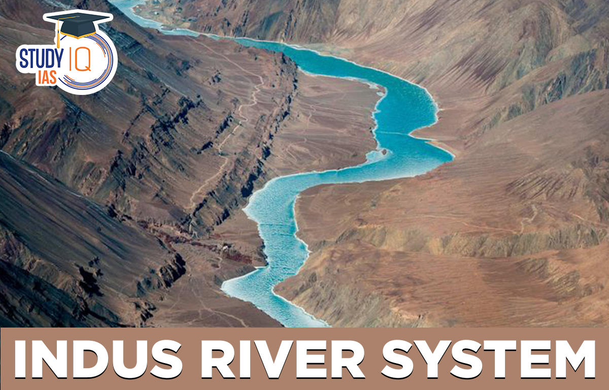
Indus River System
One of the world’s largest river basins is the Indus River System, a Himalayan river system. Sindhu is another name for the Indus River. As a result, the Sindhu River System is a component of one of the world’s and the Indian subcontinent’s most fertile regions. There were several river systems on the Indian subcontinent long before there were any civilizations. The Indus River System is one such system of rivers.
The Indus River System, which consists of the Indus, Jhelum, Chenab, Ravi, Beas, and Satluj, is made up of the principal tributaries of the Indus River. The Indus Water Treaty was signed in 1960 for the purpose of water sharing because the Indus River flows through both India and Pakistan.
The Indus River System’s distribution throughout Pakistan and India, as well as its distribution per state in India, must be understood. Indus, Jhelum, and Chenab are under Pakistan’s control, whereas Rabi, Beas, and Satluj are under India’s control, according to the Indus Water Treaty of 1960.
- Indus, Jhelum, Chenab, and Rabi rivers pass through J&K.
- The Yamuna and the rivers Chenab, Rabi, Beas, and Satluj flow through Himachal Pradesh.
- Ghaggar flows across Punjab with the rivers Rabi, Beas, Satlu, and Chenab.
Indus River System Tributaries
| Rivers | Place of origin | Indus River System Tributaries | Multipurpose Projects | States |
| Indus | Bokhar Chu- Near Manasarovar lake, Tibet | Zaskar (Ladakh), Astor Nanga Parbat), Chenab, Sutlej, Soan, Beas, Ravi, Dras, Suru (Indus), Jhelum, Kishanganga, R. Shyok, Gilgit | Kishanganga
Mangla Dam (Jhelum) Tarbela Dam(Indus) Ghazi Barotha Hydroelectric Project |
J&K
Distribution as per IWT, 1960 |
| Jhelum | Verinag spring (Pir Panjal Range) | Kishanganga (Right) Neelum Kunhar Poonch | Mangla Dam Rasul Barrage | J&K |
| Chenab | Lahaul and Spiti district of Himachal Pradesh: Bara Lacha pass | Headward Tributaries: Chandra(Zozi La) Bhaga (Baracha La) R. Tavi | Salal Project Dhulhasti Dam, Baglihar Dam Trimmu Barrage | Himachal Pradesh, J&K |
| Ravi | Kullu hills, West to Rohtang Pass | R. Soul (Valley: Rich timber trees Garden of Chamba)
R. Budhil R. Nai/Dhona Battle of the ten kings was fought |
Thein (Ranjit Sagar) Dam | J&K |
| Beas | Near Rohtang Pass, Beas Kund-H.P (southern end at Pir Panjal) | Parbati – Created problems in Alexander’s invasion of India 2014
Beas River Tragedy: Flood gates of the Larji dam were opened |
Beas Project, Pong Dam Pandoh Dam | Punjab and Haryana |
| Satluj | Manasarovar- Rakas Lakes Enters India through Shipki la Pass | T Spiti Proposal to build a 214- kilometer (133 mi) long heavy freight canal, to be known as the Sutlej-Yamuna Link (SYL) in India to connect the Sutlej and Yamuna rivers | Bhakra Nangal Project, Harike, Sirhind, Gobind Ballabh Sagar, Karcham Wangtoo Hydroelectric Plant, Neptha Jhakhari Dam | Punjab, HP, North of the Vindhya Range, South of the Hindu) Kush segment of the Himalayas, and East of the Central Sulaiman Range in Pak |
Indus River System Origin
One of the earliest human civilizations, the Indus Valley Civilization, was not only established but also called on the basis of the Indus River system.
The system is known as the Indus River System since the Indus River is its main river. The Indus River is also known as the “Sindhu” river in Sanskrit. Greek also uses the term “Sinthos” to refer to the Indus in addition to Sanskrit.
The Indus, Jhelum, Chenab, Ravi, Satluj, and Beas are the six perennial rivers that make up the Indus river system. The fact that our nation’s name, “India,” was formed from the word “Indus,” illustrates the significance of the Indus River System for the Indian subcontinent.
Indus River System Features
In India, the Indus exclusively runs through the Leh area of Jammu & Kashmir. A spring at Verinag, which is located at the base of the Pir Panjal in the southern portion of the Kashmir valley, gives rise to the Jhelum, a significant Indus tributary. It passes past Srinagar and the Wular Lake before entering Pakistan in a small, deep valley. Near Pakistan’s Jhang, it merges into the Chenab. The Chenab is the Indus River’s biggest tributary. It is created by two streams, the Chandra and the Bhaga, which converge in Himachal Pradesh near Keylong at Tandi. This leads to another name for it: Chandrabhaga.
The river travels 1,180 kilometres until it enters Pakistan. Another significant Indus tributary is the Ravi. It begins west of the Rohtang Pass in Himachal Pradesh’s Kullu Hills and runs through the Chamba Valley. It drains the region located between the southern Pir Panjal range and the Dhauladhar ranges before entering Pakistan and meets the Chenab near Sarai Sidhu. Another significant Indus tributary, the Beas, rises from the Beas Kund, which is about 4,000 metres above mean sea level and is close to the Rohtang Pass. The river creates canyons at Kati and Largi in the Dhaoladhar Mountain as it runs through the Kullu valley. When it reaches the Punjab plains, it merges with the Satluj close to Harike.
Indus River System Description
The Indus River System is one of the longest river systems in the subcontinent, measuring a total of 2900 km. The Indus River System’s overall drainage area is approximately 11 lakh 65 thousand square kilometres. However, Pakistan now includes the majority of this region. Below is an explanation of the rivers that make up the Indus river system, along with their points of origin-
Indus River System: Indus River
The Kailash range glaciers at Mansarovar Lake are the source of the Indus, the principal river of this river system. The Indus River has a length of around 2880 km, of which only 710 km are in the Indian state of Jammu & Kashmir; the remaining distance is divided between Pakistan and Tibet.
It comes from a glacier in Tibet’s Bokhar Chu region, close to Manasarovar Lake. The Himalayan Mountains, Hindu Kush, and Karakoram Range make up the majority of the landscape; the rest is made up of Pakistan’s semiarid plains.
Tributaries:
- Zaskar (Ladakh)
- Astor (Nanga Parbat)
- Chenab, Sutlej, Soan, Beas, Ravi,Dras, Suru (Indus), Jhelum, Kishanganga, R. Shyok, Gilgit,
- Shigar/Sangar+Kabul+ Kurram Gomal – Tochi +Viboa- Originate in Sulaiman Ranges
- Harike Barrage, at the confluence of the Beas and Sutlej: Channels water into the Indira Gandhi
Indus River System: Jhelum River
The Jhelum River also referred to as Vitusta in the Rgveda, Hydaspes in Greek, and Veth in Kashmir, is the next significant river in the Indus river system. Before it merges into the Chenab River in Pakistan, it travels a distance of about 720 km from its glacier of origin, the Chashma Verinag. The Jhelum River reaches Pakistan after passing through the Indian state of Jammu & Kashmir.
Indus River System: Chenab River
The river Chenab, also known as Asskini Chandrabhaga, is another crucial river in the Indus river system. In the West Himalayan region of the Himachal Pradesh state, the Chenab River joins the rivers Chandra and Bhaga. The Baralacha La Pass serves as the streams’ primary water source. Before joining the Indus River, the Chenab River passes through Himachal Pradesh and Jammu and Kashmir. It is the Indus River System’s biggest tributary.
Indus River System: Ravi River
The river Ravi, also referred to as Iravati or “The River of Lahore,” is the next tributary of the Indus river system. The Ravi begins its journey near Rohtang Pass in the Himachal Pradesh district of Chamba, and after about 720 kilometres, it joins the Chenab River in Pakistan. Himachal Pradesh and Jammu and Kashmir are two Indian states that are traversed by the Ravi. It passes through Shahdara Bagh, which contains the tombs of Jahangir and Noor Jahan, between the Pir Panjal and Dhauladhar Ranges.
Indus River System: Beas River
An important river that contributes to the Indus river system is the Beas. The Beas Kund in the Rohtang La pass in the Indian state of Himachal Pradesh is where the Beas River begins to flow. The Beas travels about 470 kilometres from its source in Himachal Pradesh to Punjab, where it merges with the Satluj River. As a result, the Beas River flows through the Indian states of Punjab and Himachal Pradesh.
Indus River System: Satluj River
The Satluj River is one of the Indus River’s most significant tributaries. Of all the Indus river system’s tributaries, it is the longest river. The Rakkas Lake, also known as Lake Rakshastal, is where Satluj first appeared. The Satluj River originates in Pakistan and flows through the states of Himachal Pradesh and Punjab before entering India via the Shipki La Pass and joining the Chenab River. The Satluj River has a total length of 1450 km, of which 1050 km are located in Indian Territory.
Indus River System UPSC
- Projects like the Indira Gandhi Nahar Project, Beas-Sutlej Link, and Madhopur-Beas Link have made it possible for India to use nearly all (95%) of the water from Eastern Rivers.
- The Shahpurkandi Project will assist in using the waters spilling from Thein Dam’s powerhouse for irrigation and power generation in Punjab and J&K. The Punjabi government is carrying out the construction work under the supervision of the Indian government.
- The major Indus River, Jhelum, Chenab, Ravi, Beas, and Sutlej are all part of the Indus system. With a little portion going to China and Afghanistan, the basin is primarily shared by India and Pakistan.
- India has also been granted permission to use run-of-river (RoR) projects on the Western Rivers to generate hydroelectricity, which is unrestricted subject to certain design and operation requirements.
Indus River System FAQs
Q What are the major tributaries of the Indus river system?
Ans. Jhelum, Chenab, Ravi, Beas, and Satluj rivers make up the bulk of the Indus river system.
Q Under the Indus water treaty India is permitted to utilize the waters of which rivers?
Ans. According to the Indus River Treaty, Pakistan will receive water from the rivers Indus, Jhelum, and Chenab, while India would use the rivers Ravi, Satluj, and Beas.
Q How old is the Indus river system?
Ans. The Indus river system is a very old river system since evidence suggests that it predated the construction of the Himalayas.
Q What is the total catchment area of the Indus river system?
Ans. Around 11,65000 square kilometres make up the total catchment area of the Indus River System, of which only 3,21,248 square kilometres are located in India.
Q What are the main characteristics of Indus River system?
Ans. The river originates at a height of roughly 18,000 feet near Lake Mapam in the southwest Tibet Autonomous Region of China (5,500 metres). It runs northwest for around 200 miles (320 km), passing the disputed Kashmir region’s southeast border at a height of about 15,000 feet (4,600 metres).
Q Why is Indus River system important?
Ans. The breadbasket of Sindh and Punjab province, which produce the majority of the country’s agricultural output, rely heavily on the Indus for their water needs. It also sustains a number of heavy industries and is Pakistan’s primary source of drinkable water.
Other Indian Geography Topics
Other Fundamental Geography Topics


 WhatsApp