Table of Contents
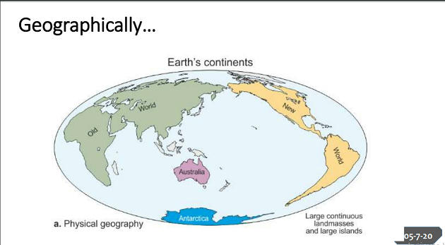
Define Continent…
- Most modern dictionaries state it more directly as ‘one of the Earth’s large continuous landmasses.’ This sounds reasonable enough. But how large is large?


Oceans didn’t allow the continent to be discovered
- At least three years ago, the lead author of the two maps developed of the submerged eighth continent had told a separate media outlet that if the scientists could ‘pull the plug’ on the oceans across the globe, it would reveal that Zealandia ‘stands out’.
The Quest began in 2017.. (It was called drowned continent back then)
- Reaching a significant milestone to the quest that began in 2017, scientists have now mapped the submerged landmass of the eighth continent deep beneath the Pacific Ocean.
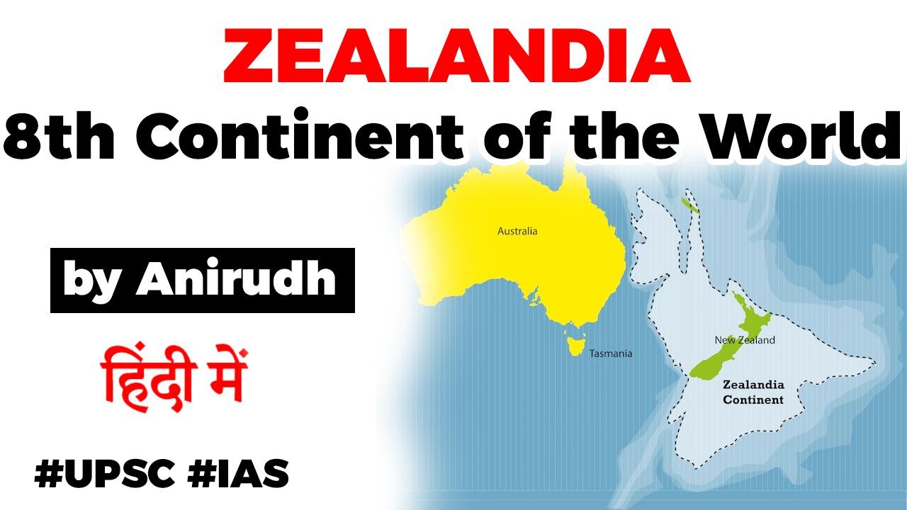
- New Zealand “sits on” the five million square kilometres Zealandia that was first spotted years ago.
- But researchers at GNS Science in New Zealand have developed two maps only recently that give insights into the “amazing forces” that shaped the continent.
- Calling them a “scientific benchmark”, the lead author of the tectonic & bathymetric maps, Dr Nick Mortimer has also said that they are “accurate” and “complete”.
Features of Zealandia
- Zealandia — or Te Riu-a-Māui, as it’s referred to in the indigenous Māori language — is a 2 million-square-mile (5 million square kilometers) continent east of Australia, beneath modern-day New Zealand.
- Scientists discovered the sprawling underwater mass in the 1990s, then gave it formal continent status in 2017.

ALmost 95% of its land mass is submerged
- Earth’s mysterious eighth continent doesn’t appear on most conventional maps; that’s because almost 95% of its land mass is submerged thousands of feet beneath the Pacific Ocean.
- The land mass may have been completely submerged about 23 million years ago.
GNS Science
- Now, GNS Science — a geohazards research and consultancy organization owned by the government of New Zealand — hopes to raise Zealandia with a suite of new maps and interactive tools that capture the lost continent in unprecedented detail.
- The new maps reveal Zealandia’s bathymetry (the shape of the ocean floor) as well as its tectonic history, showing how volcanism and tectonic motion have shaped the continent over millions of years.
- Data for the bathymetric map was provided by the Seabed2030 project — a global effort to map the entire ocean floor by 2030.


Latest Burning Issues | Free PDF


 WhatsApp